SG crestA Singapore Government Agency WebsiteHow to identify
Official website links end with .gov.sg

Government agencies communicate via .gov.sg websites (e.g. go.gov.sg/open). Trusted websites

Secure websites use HTTPS

Look for a lock () or https:// as an added precaution. Share sensitive information only on official, secure websites.

History of Rifle Range Nature Park

About Rifle Range Nature Park

Rifle Range Nature Park takes its name from Rifle Range Road, which served as the access road to Bukit Timah Rifle Range. The range was built in 1924 by the Public Works Department, primarily to serve Singapore’s volunteer forces. By 1930, the road was named after the rifle range, which later became the home of the Singapore Gun Club.

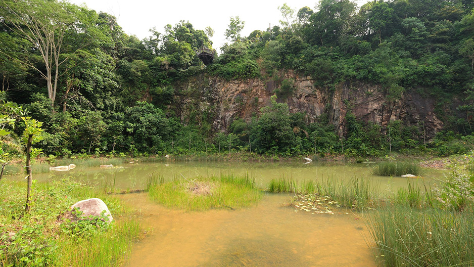
The nature park itself is located at the site of the former Sin Seng Quarry, which is part of a cluster of quarries in the Bukit Timah area, which also includes Hindhede Quarry and Singapore Quarry. Once part of Singapore's booming construction industry in the 1980s and 1990s, a number of these disused quarries are now incorporated into the following parks and nature parks:

You can go on the 11km Scenic Quarries self-guided walk to view these quarries.

View a guide to the trails (includes map).

Rifle Range Nature Park is also part of the Central Nature Park Network. Nature parks are established at the edges of nature reserves to serve as green buffers from the impact of urbanisation in order to protect and safeguard the flora and fauna in the nature reserves.

Learn more about our nature reserves and nature park networks.

Today, the forests of Rifle Range Nature Park are estimated to be around 30 years old and are in the "early successional stage" of forest regeneration. Cultivated fruit crops within the nature park also highlight the existence of former inhabitants who lived in kampungs within the area.