Official website links end with .gov.sg
Government agencies communicate via .gov.sg websites (e.g. go.gov.sg/open). Trusted websites

Secure websites use HTTPS
Look for a lock ( ) or https:// as an added precaution. Share sensitive information only on official, secure websites.
-
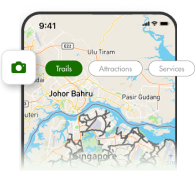
- Find a park or park connector
-
- Arts or heritage appreciation
- Barbecuing
- Birdwatching
- Camping
- Cycling or inline skating
- Dining
- Fishing
- Fitness studios
- Fun with children
- Fun with your dog
- Hiking
- Kite flying
- Mountain biking
- Nature walks or tours
- Photography
- Skateboarding
- Sandcastle building
- Shopping
- Staycation
- Therapeutic gardens and therapeutic horticulture programmes
- Water sports
- Wellness
- Festivities and promotions
- Events
Government official impersonation scam alert
Government officials will NEVER ask you to transfer money or disclose bank log-in details over a phone call. Call the 24/7 ScamShield Helpline at 1799 if you are unsure if something is a scam.